Mapbox Streets
Mapbox Streets is our flagship style, it is a comprehensive, general-purpose map that emphasizes accurate, legible styling of road and transit networks.

Vibrant colors
The Mapbox Streets high-contrast color system allows the viewer to easily recognize the map's features and quickly understand its hierarchies and classifications. The color system is fine-tuned to work perfectly at each level and shifts subtly across zooms.
Detailed transit styling
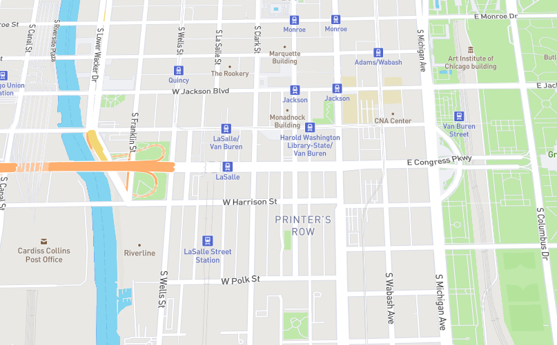
Mapbox Streets includes a wide variety of transit layers – from motorways to paths to ferries – and has been designed to provide an intricate rendering of their routes, intersections, and overlaps. In select cities and countries, Mapbox Streets also features local public transit icons and highway shields to help orient the user and connect the map to their environment. For increased legibility and consistency, the Cartography Team designed each global transit over a two dozen icons and added them to this map to add in place and comprehension for global usage.![]()
![]()
Points of interest (POIs)
Mapbox Streets features a broad range of POIs styled to indicate category and filtered to only show the most important POIs across the zoom range. These icons from our set of open source Maki icons. Maki icons are designed simply and work seamlessly with Mapbox Studio. The Maki icon editor allows you to customize the style of your icons you can add and remove these icons, categorize and style them in groups, and download them for your map styles.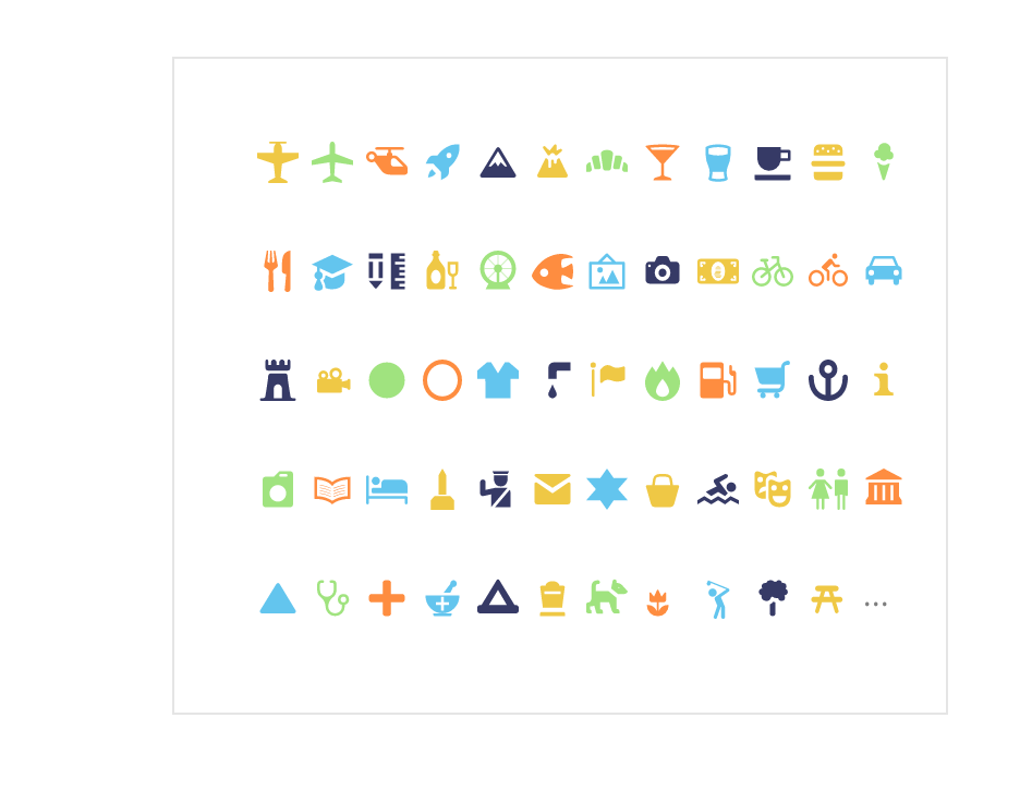
Additional design features
Roadways. Highly organized road data, designed to present a clearly legible hierarchy of all road types across a wide zoom range.
Administrative boundaries. A global political and administrative boundary layer.
Built features. Building footprints, rail stations, urban parks, land use, famous landmarks, and neighborhood stores.
Natural features. Rivers, lakes, streams, oceans, coastal boundaries, parks, land cover, and beaches.
Places. A complete hierarchy of location labels, from countries and states down to villages and neighborhoods.
Terrain. Vivid hillshading show elevation, contour lines, and a tactile topography.
Unique iconography. Select countries and cities feature custom highway shields and public transit icons.